Photo exclusive to CultureMap
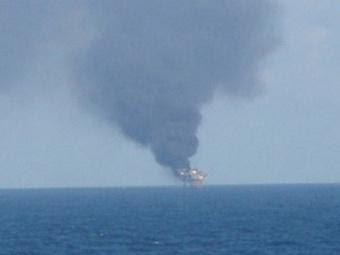
A picture of the site of the Mariner Energy oil rig fire.

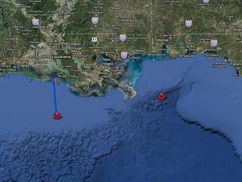
Courtesy of Shane/Google Maps
Reports from the U.S. Coast Guard put the latest explosion of an oil platform in the Gulf of Mexico about 128 kilometres off the Louisiana coast, west of the site where BP's undersea well spilled after a rig explosion. The fire logo with the blue line marks the approximate site of the Mariner Energy explosion. The other icon notes the site of the Deepwater Horizon explosion and leak.
CultureMap acquired the first picture of the Mariner Energy oil rig fire. The photo taken from a distance shows the platform burning.
Thirteen workers were rescued from the rig — one had injuries.The Coast Guard sent in seven helicopters and several vessels to pull off a rescue. Mariner Energy's Patrick Cassidy first told CNBC that early indications are that no oil was spilled in the incident, but now the Associated Press is reporting that there is a one-mile-long visible sheen.
Mariner Energy is a Houston-based company and the photo came from a source of editor-at-large Shelby Hodge.
By Chris Baldwin
[Source]


0 komentar:
Post a Comment